
Trace Gadsden Streets by Address
A sound Gadsden street directory search starts with one known address and expands one source at a time. The address anchors the parcel, the parcel anchors the legal description, and the legal description keeps the deed trail tied to the same land even when names or numbers change. Occupancy needs its own proof. A tax owner may live elsewhere, while a directory-listed person may have lived at the site without holding title.
- Normalize the address with the USPS lookup. Save the standardized street, city label, and ZIP, but do not treat the postal city as proof of Gadsden jurisdiction.
- Search the Etowah County property portal by address. Record the tax year, indexed owner spelling, PIN, parcel, account, subdivision, situs, and mailing address fields that appear.
- Plot the parcel in the county viewer and the Gadsden Property Browser. Check lot lines, nearby parcels, road labels, city limits, annexation context, and any book or page notation.
- Use the current owner and instrument reference to enter the Probate deed chain. Search each seller as an earlier grantee, and confirm each link with the same legal description.
- Check the voter roll route with care. VoterView verifies one person and is not a by-street roll; any lawfully obtained statewide file remains subject to current statutory limits.
- Finish with reverse or alphabetical directories, released census schedules, permits, and dated newspaper items. Label each person as owner, applicant, voter, subscriber, or directory-listed occupant.
The result is an evidence trail, not a single answer box. That distinction is vital when the question is who owns on a Gadsden street versus who actually lives there.
Search Gadsden Property Records
Etowah County AssuranceWeb is the main address-to-parcel entry point for a modern Gadsden by-address search. Its search modes are more useful than a broad web query because they expose several ways to recover a parcel when an address fails. Start in Address mode, then retry with the owner spelling, parcel, PIN, account, company, or subdivision that another official record supplies.
| Portal field | Input | Required | Use in a street search |
|---|---|---|---|
| Tax Year | Selector or input | No visible marker | Fixes the assessment year being viewed |
| Search By | Mode | One mode | Name, PIN, Company, Parcel, Account, Subdivision, or Address |
| Last Name Starts With | Match option | No | Broadens an owner-name retry |
| Last Name Contains | Match option | No | Finds a surname embedded in the indexed form |
| Owner last name | Text | For name mode | Uses the indexed surname |
| Owner first name | Text | No | Narrows a common surname |
| Print Results | Button | No | Preserves the displayed result for comparison |
The official Etowah property search is shown below as the county presents it.
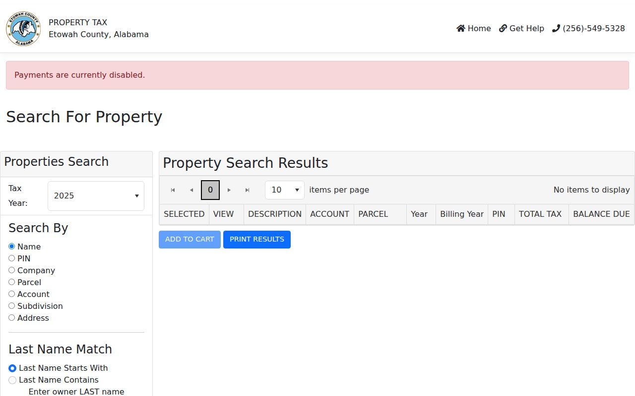
The captured form confirms that address is one mode among parcel and owner identifiers, which makes a failed house-number search recoverable.
Read the Gadsden Parcel Map
The Etowah County parcel viewer turns a result row into land on the map. The underlying county service includes address annotations, roads, rights-of-way, parcel lines and polygons, acreage, dimensions, lot and parcel numbers, subdivision book and page data, buildings, city limits, voting and fire districts, cemeteries, churches, streams, easements, and other tax-map context. It is marked for tax purposes only, so map geometry helps with identification but does not replace a recorded deed.
Search or zoom to the target, inspect the parcel, and click adjacent polygons one at a time. The Etowah mapping guide explains the county parcel-number format and why assessment ownership can lag a recorded deed. No official automatic neighbor report or radius list was found. The map is still a practical way to walk a Gadsden block consistently because each click can be logged with parcel number, situs, owner label, and boundary context.
The county parcel-viewer source appears in the captured image below.
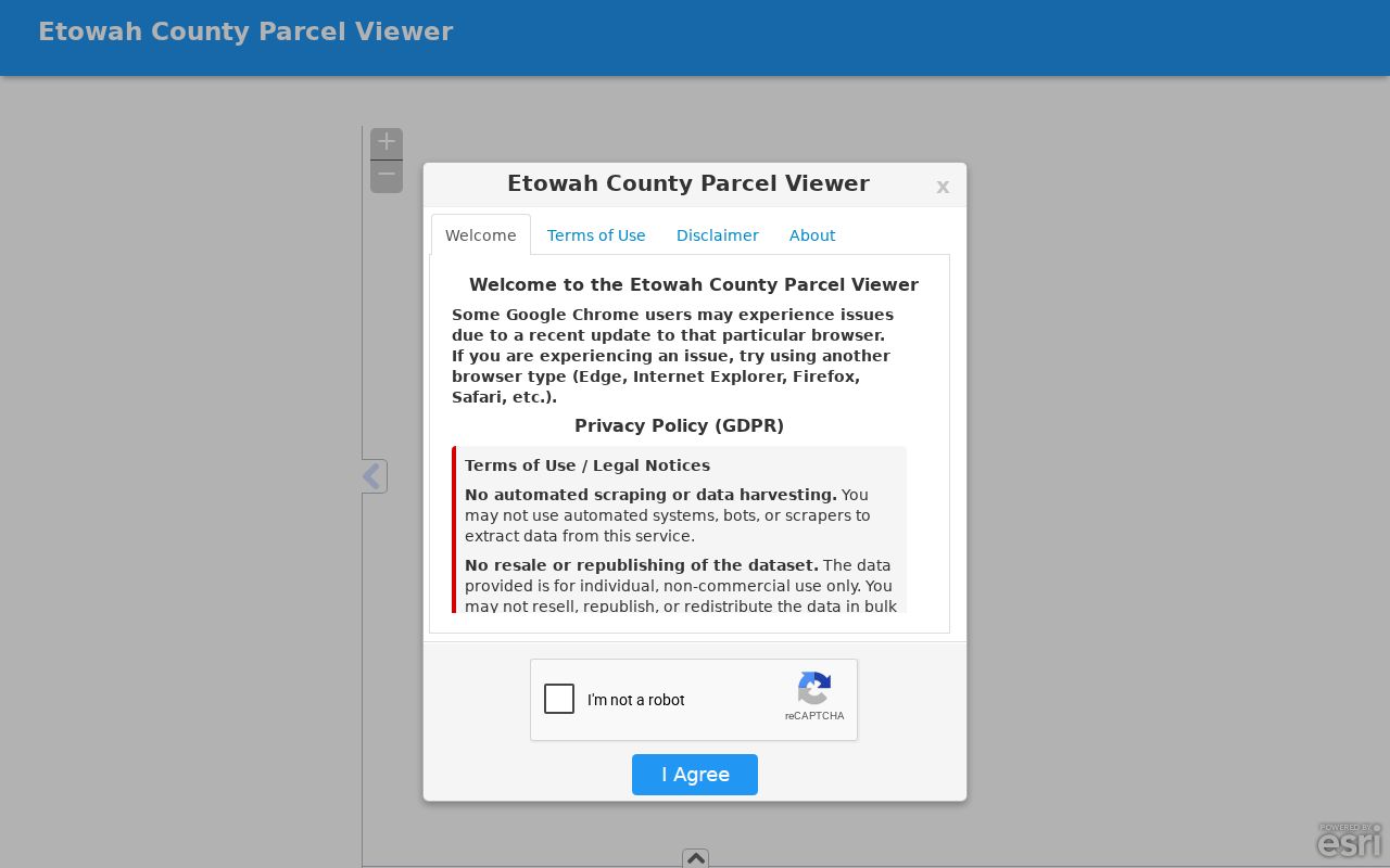
This view supplies the parcel geography needed before moving from an address label to ownership and deed records.
Gadsden Street Directory Coverage
No single custodian keeps a complete Gadsden street directory. The best chain combines the following address-keyed sources and preserves the label each source can truly support. Online access is only the first channel. Failed searches move to the Revenue or Mapping staff, the Probate counter, the Building Department, or the library desk.
| Address source | Local keeper | Evidence supplied | Access route |
|---|---|---|---|
| Assessment and tax parcel | Etowah Revenue Commissioner | Indexed owner, situs, mailing address, parcel identifiers | AssuranceWeb or Room G-15 counter |
| Parcel geography | County Mapping and Gadsden GIS | Lot, road, city limit, annexation, subdivision, zoning context | Two free viewers or staff contact |
| Deed, mortgage, and plat | Etowah Probate Judge | Named parties, instrument, legal description, recording facts | Authenticated portal or courthouse books |
| Voter evidence | Alabama Votes and registrars | Individual status and precinct, or a regulated statewide file | VoterView or Board of Registrars |
| Permit and code material | Gadsden Building Department | Site, applicant or contractor, work and case dates | Current platform or office request |
| Historical directories | Gadsden Public Library | Publication-year occupant or telephone subscriber | Reference and genealogy desks |
For an office fallback, the Revenue and Appraisal unit is at the Etowah County Courthouse, 800 Forrest Avenue, Room G-15. Mapping can be reached at 256-549-8143. The Board of Registrars is in Suite 206 at the same address and can explain lawful voter-record access.
Gadsden Owners Are Not Occupants
A common Gadsden street directory myth is that the parcel owner must be the resident. The county parcel may show a titled owner and a separate mailing address. That mailing address is where the tax notice goes, not proof that the owner lives at either place. Homestead treatment can support an occupancy inference, but it still does not name every person in a household.
Keep an evidence label beside every name. Use owner for the assessment or deed party, mailing addressee for the tax destination, permit applicant for a permit, registered voter for a verified election record, and directory-listed occupant for a historical directory. Non-owner occupants and other household members are not comprehensively indexed on the property roll. This simple labeling rule prevents a by-address list from becoming a false list of current residents.
- Parcel
- A mapped unit of land identified for tax and land-record work.
- Situs address
- The physical location assigned to the parcel, distinct from the owner's mailing address.
- Plat
- A recorded map that identifies lots, blocks, boundaries, or a subdivision.
- Criss-cross directory
- A directory section arranged by street or address rather than by a person's surname.
Follow a Gadsden Deed Chain
Once the parcel is stable, the Etowah County Deeds and Records route carries the street search into legal ownership. Use the current owner's acquisition reference, then capture the grantor, grantee, execution and recording dates, instrument or book and page, legal description, and any prior-instrument reference. Search the seller as an earlier grantee and repeat. Matching a surname alone is weak; matching the same lot, block, metes-and-bounds description, or parcel lineage is far stronger.
The county records deeds, mortgages, deeds of trust, plats, liens, property contracts, mortgage assignments, lis pendens, condominium instruments, and other listed document classes. Its web database may contain omissions or additions and is not the official record. If an image or index entry is missing, use the authenticated portal or ask for the courthouse index and deed book at 800 Forrest Avenue. The county does not publish the online starting year or image price, so neither belongs in a reliable street directory claim.
Note: Use the online index to discover a filing, then treat the courthouse instrument as the final authority.
Date Gadsden Address Changes
The Gadsden Building Department holds permits, inspections, nuisance matters, and zoning-related material tied to sites. A permit can date a repair, addition, demolition, or regulated change and may name an applicant or contractor. It does not establish that the named party occupied the building. Gadsden moved to a new permit platform in May 2025, while the public cutoff for older online material was not verified.
Use the portal when it returns the site, then ask the department for older or missing address records. Record the exact address, permit or case date, type of work, and the role attached to each name. The city GIS can add condemned-property, nuisance, historic-district, zoning, floodplain, footprint, and annexation context. Those planning layers describe the site and its jurisdiction; they do not create a household roll.
Resolve Gadsden Street Conflicts
The best local insider tip is to test more than one official address form. Gadsden resolutions document city and county number disagreements at 1412 versus 1410 Alabama Street and 1823 versus 1323 Arizona Street. When a parcel vanishes, search both numbers in the tax portal, parcel viewers, permit system, deed references, and directory years. Save which variant produced each match.
Street names can change too. South 26th Street became Minth Boulevard in 2026, so a current search and a historic search require both labels. The legal description and parcel lineage can bridge results even when the street name in an older deed differs from today's sign. The 1951 Chamber map and the title year of a city directory provide more checks for older alignment.
Read Historic Gadsden Streets
The Gadsden Public Library genealogy and reference collections hold a near-complete run of city directories from 1900. Start with the address only if the selected volume has a reverse street section. Not every year is known to include one. Otherwise, search the alphabetical section for a known surname, record the exact entry, and inspect the title page and abbreviation key before interpreting marks.
For June 1933 through May 1946, the digitized Library of Congress telephone run can corroborate a subscriber and address, but it is not a census of all homes. Pair the nearest directory years with the released 1940 or 1950 federal census, then use Gadsden Times microfilm from 1867 forward for dated notices and obituaries. Details about the collection years belong on the Gadsden city directories page; the street task is to log exactly what one chosen year says about the address.
Verify Gadsden Postal Geography
A postal Gadsden label does not prove the parcel lies within city limits. ZIP delivery territory and municipal jurisdiction answer different questions, especially near Glencoe, Rainbow City, Attalla, Reece City, and annexed corridors. After USPS normalizes the address, compare the county parcel viewer with city-limit and annexation layers in the Gadsden Property Browser route.
Keep three address forms: the parcel's situs, the tax account's mailing destination, and the deed or plat's legal description. An annexation can change jurisdiction while the familiar postal label remains. The city's annexation form itself requests the owner, street address, and legal description, a useful reminder that these fields coexist but are not interchangeable.
Limits of Gadsden Street Records
A Gadsden street directory cannot expose a complete current household roll. Property records omit non-owner occupants and many family members. VoterView checks an identity-matched person and cannot browse a whole block. A directory can miss a home because of a publication gap, canvass error, unlisted telephone, or name variation. Utility-customer data was not found as a public address channel, and driver-address information is restricted by federal law.
Some records also lawfully withhold details for victims, shelters, court matters, vital events, and other protected situations. A blank result may mean the source is incomplete, the address changed, or the record is restricted. It is not proof that no one lived at the site.
Lawful use. Use Gadsden address records only for lawful personal research. Never use a street search to stalk, harass, intimidate, or harm anyone.